Connected wayfinding formed a pillar of Destination Cleveland’s multi-million dollar investment to transform the city.
The Seamless Cleveland Master-plan was designed to create a positive welcome, connect parts of the city and tap into Cleveland’s rejuvenated appeal and brand.
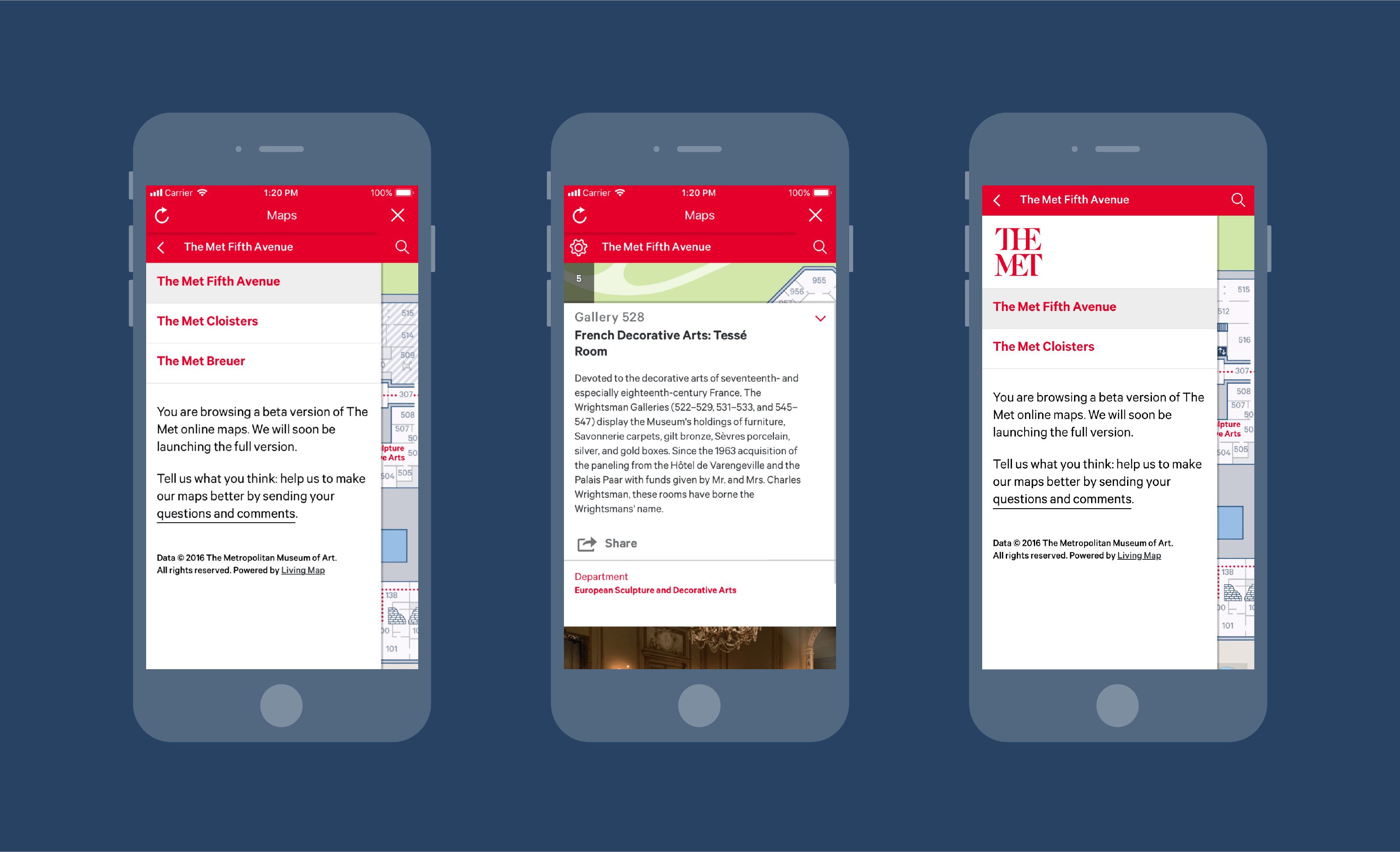
A connected information strategy was followed by prototypes, testing and systemisation. Implementation included a street sign system, transit integration, airport connections and an online mapping tool; all devised to deliver seamless journeys.
Cleveland has now significantly changed perceptions, connectivity and visitor numbers.
increase in visitors since 2011
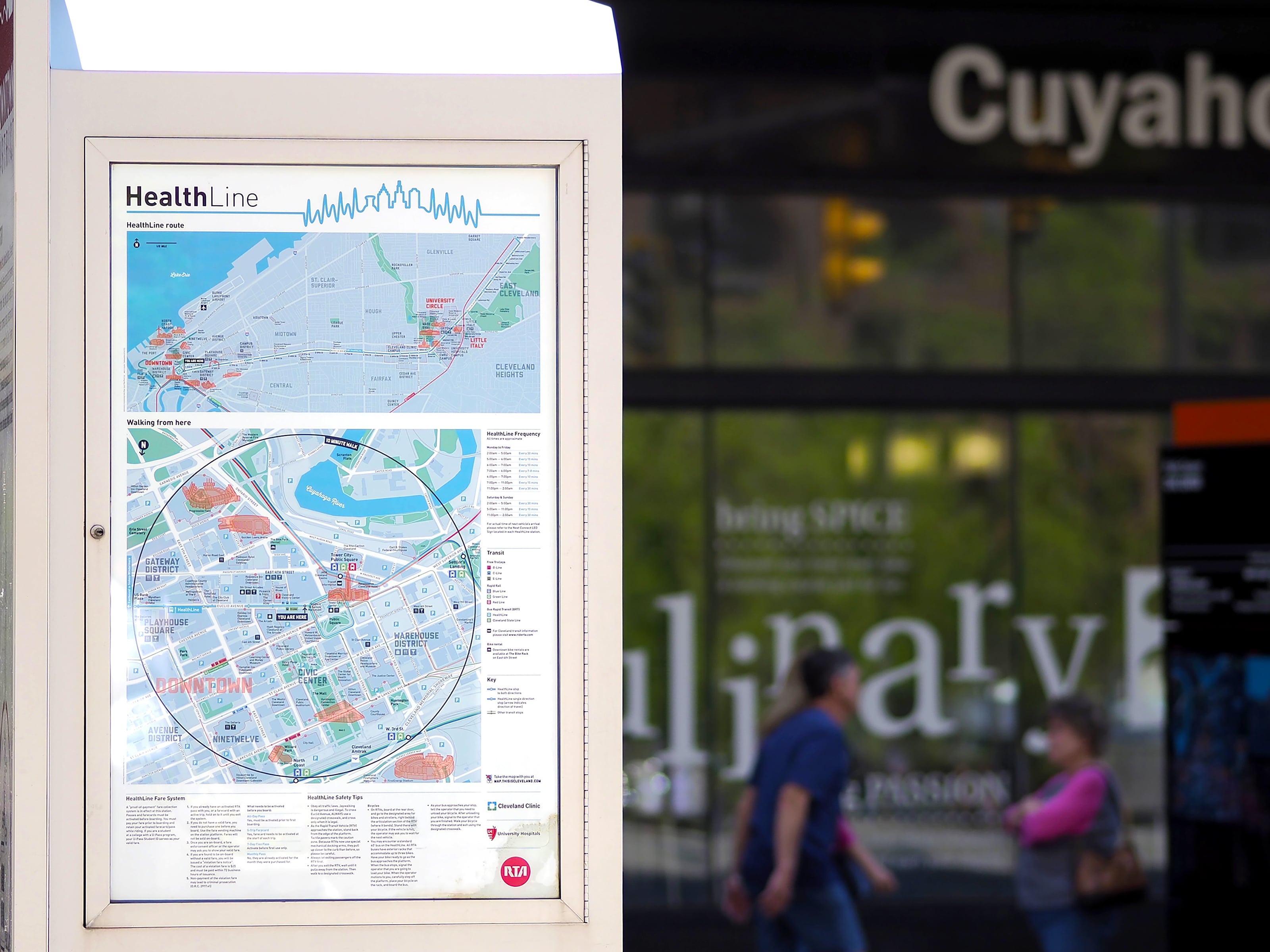
transport modes integrated


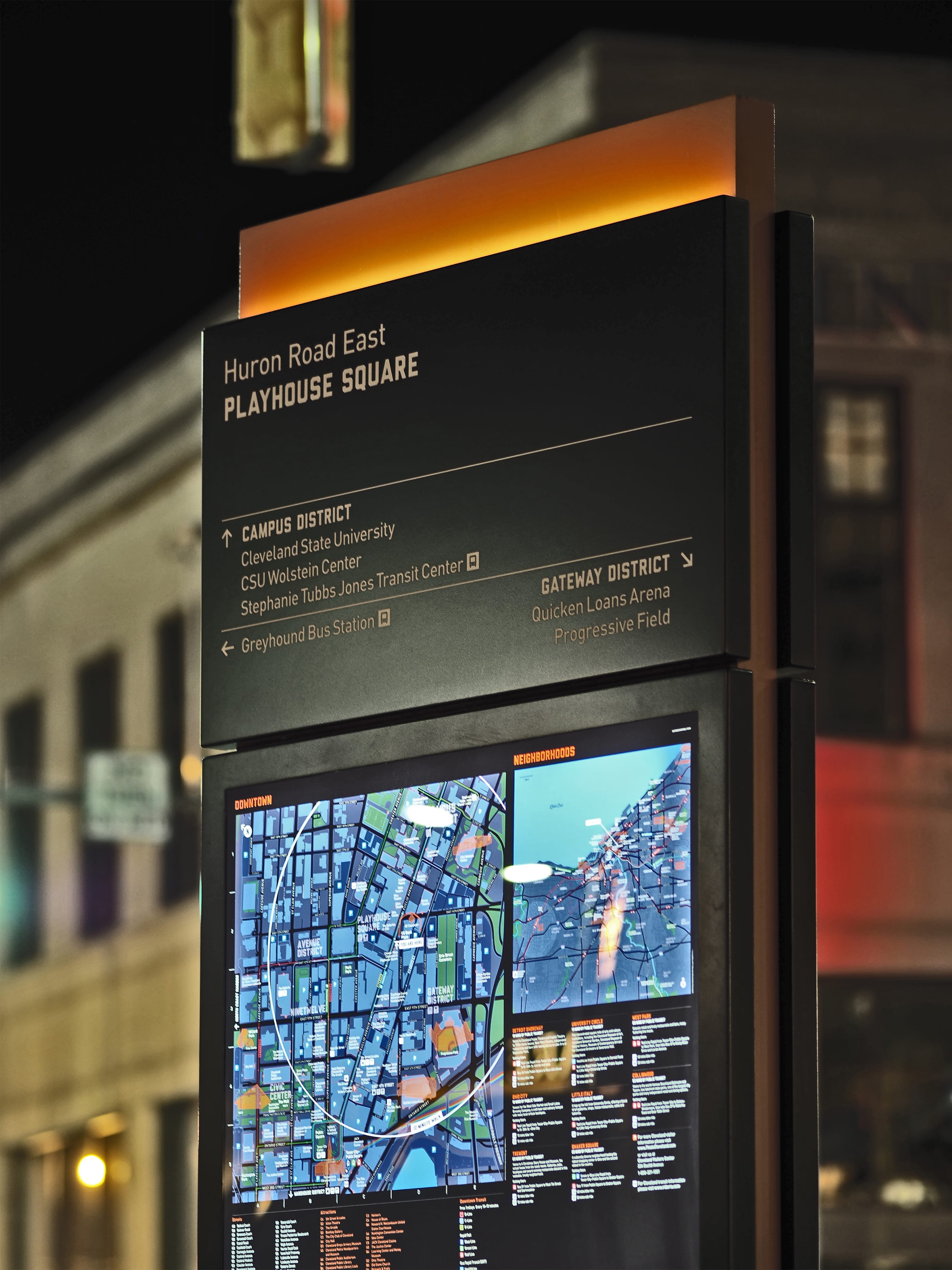


Legibility masterplanning
Development of a masterplan to create and set the vision for Cleveland. This focused on the visitor and user experience, while connecting different parts of the City and its different transport modes.
Talking to locals and visitors showed how the city had a number of centres of interest, yet many were unaware. Creating a picture to inform and encourage visitors to see the whole city would help change this.
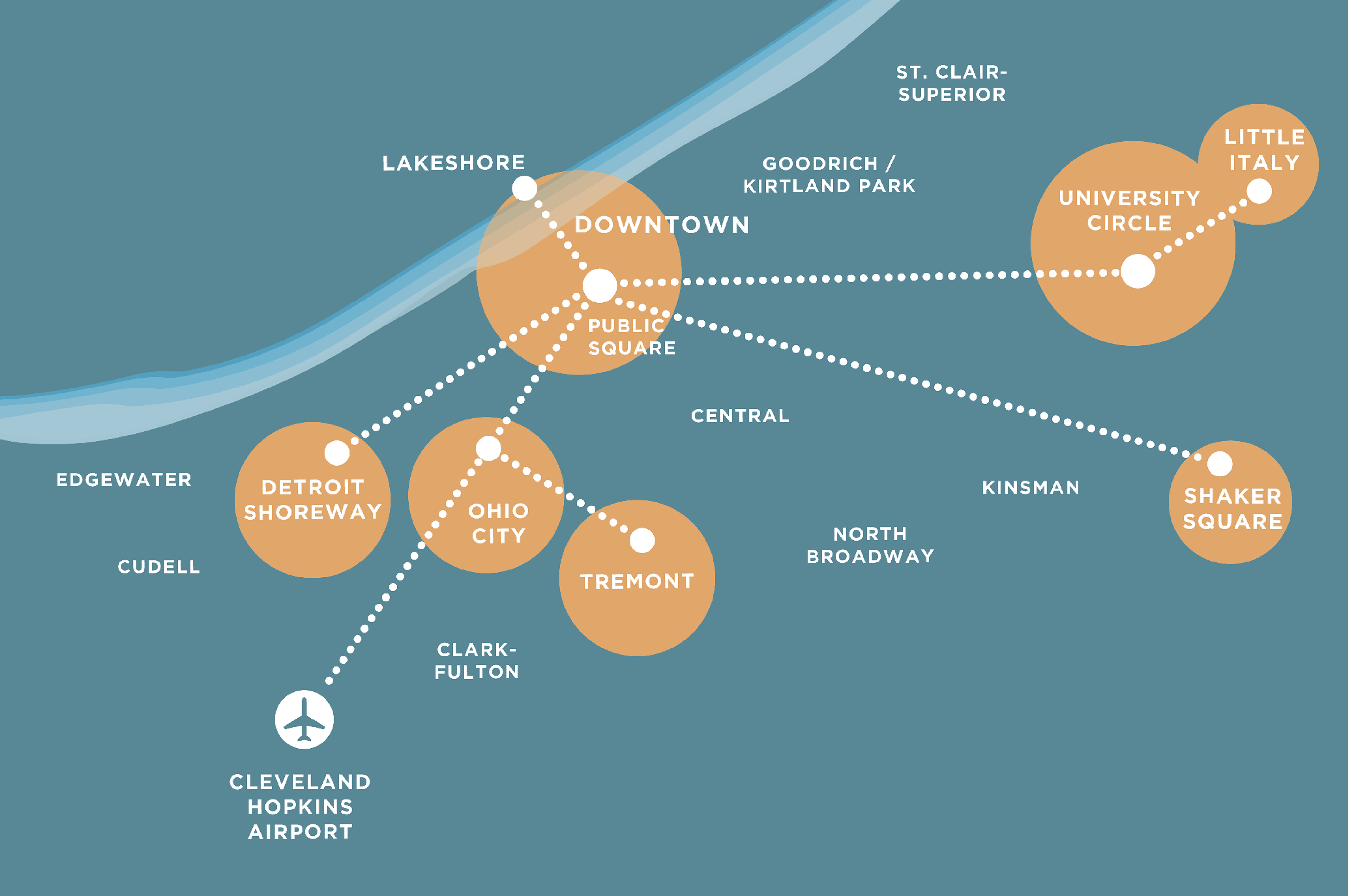
Complex mapping system
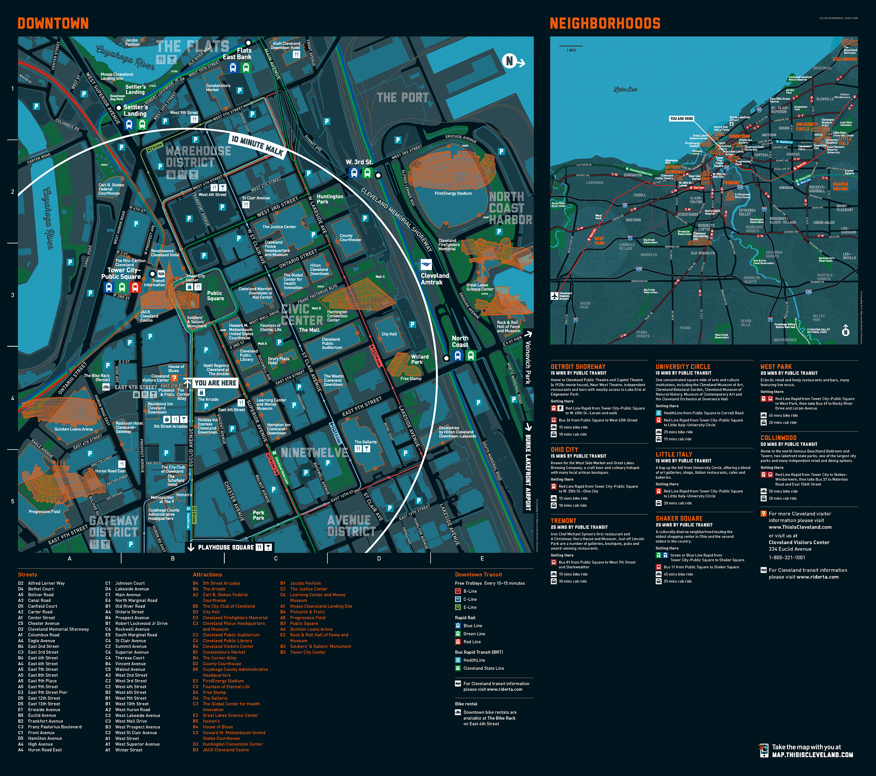
A complex mapping system built around the overlay of city assets and features spanning across multiple districts including Downtown Cleveland. This was designed to provide detailed local context as well as create citywide awareness.
Wide business engagement
Destination Cleveland Annual Meeting proved an opportunity to engage a large number of stakeholders with the project through an exhibition and a series of talks.
High quality products
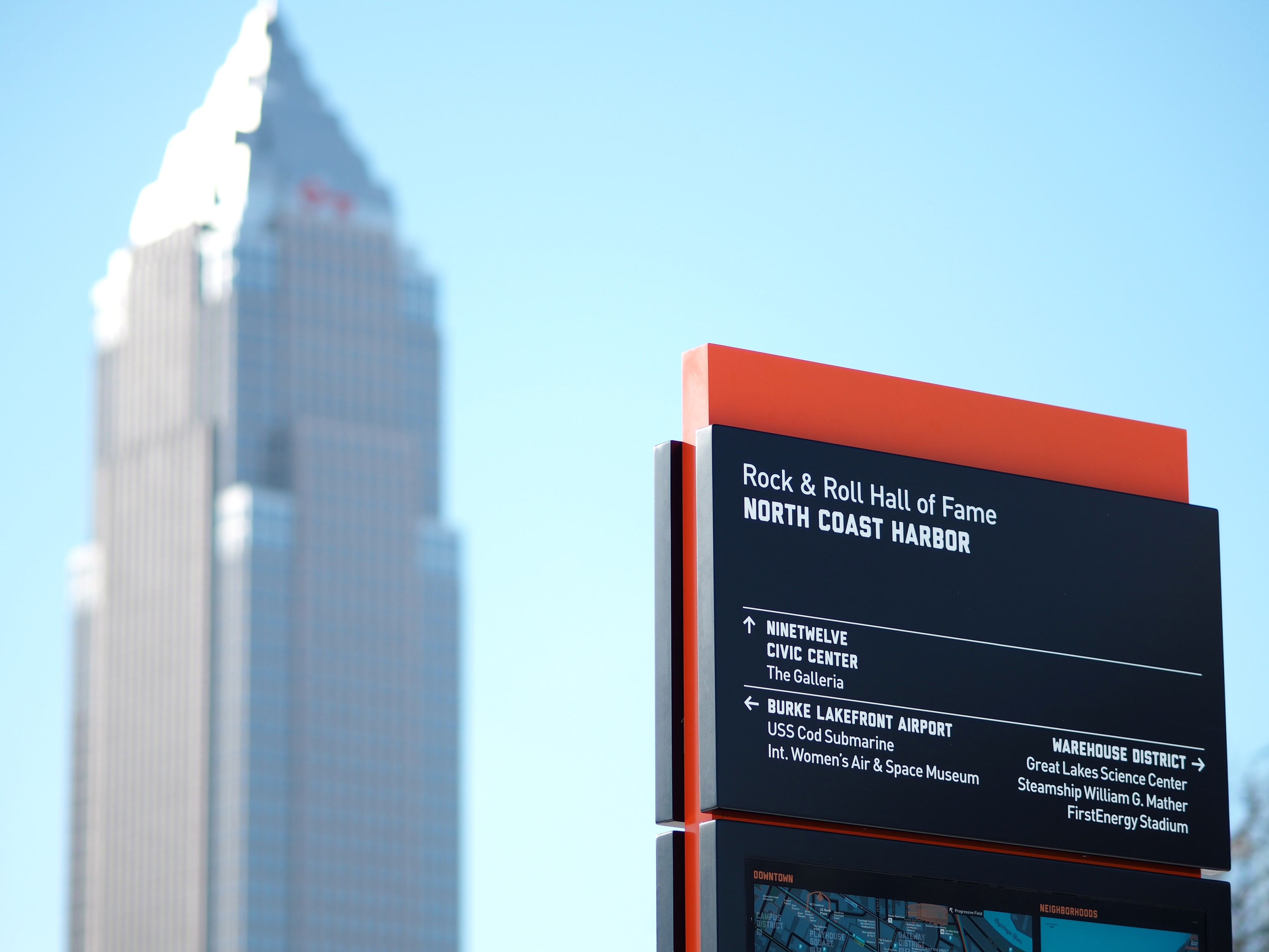
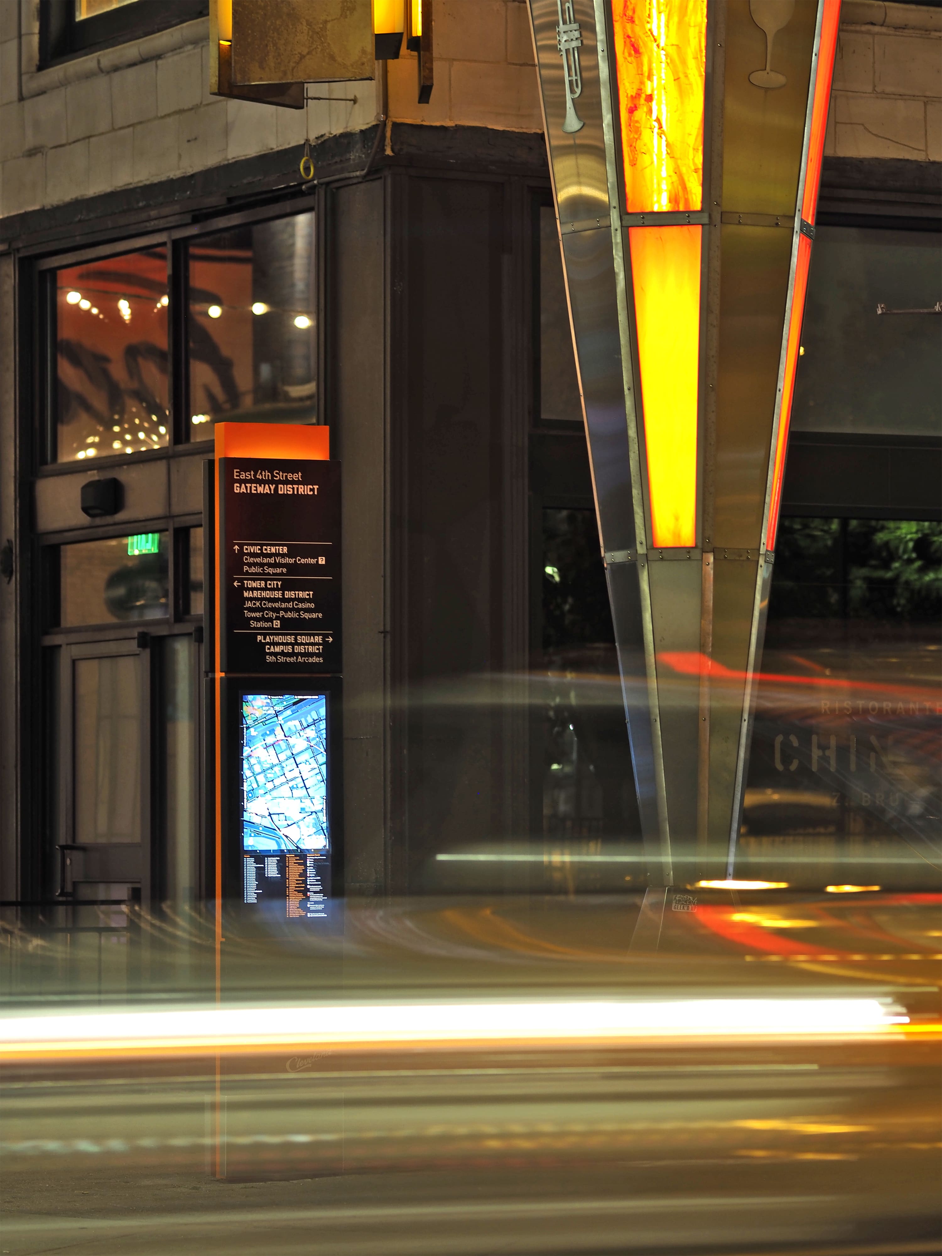
Map-based totems placed in strategic locations. They were designed to integrate with the urban fabric, and illuminated to ensure readability and a welcome when dark.

System expansion
The creation of a set of design standards and assets allowed for expansion to a number of environments. This included the welcome at the airport and on improved transport routes. Information to help people navigate and raise awareness took the form of analogue signs, digital applications and print materials.