Transport is the number one problem limiting the growth of the heart of the Canadian economy. The region has a legacy of multiple transit operators with little coordinated transit information.
Research highlighted the problems this causes for cross network journeys and the resulting impact on car use.
Aligned with an unprecedented $50bn investment in infrastructure, Applied have been developing a Harmonized standard for transit wayfinding information across the region. This aims to make sense of the complex transit opportunities to deliver long-term mode shift.
11 transit operators
6 transportation modes
72.6 million transit trips per year
500 km rail and rapid transit routes
Operating in the most populous metropolitan area in Canada, Metrolinx’s goal was to achieve seamless integration of public transit.
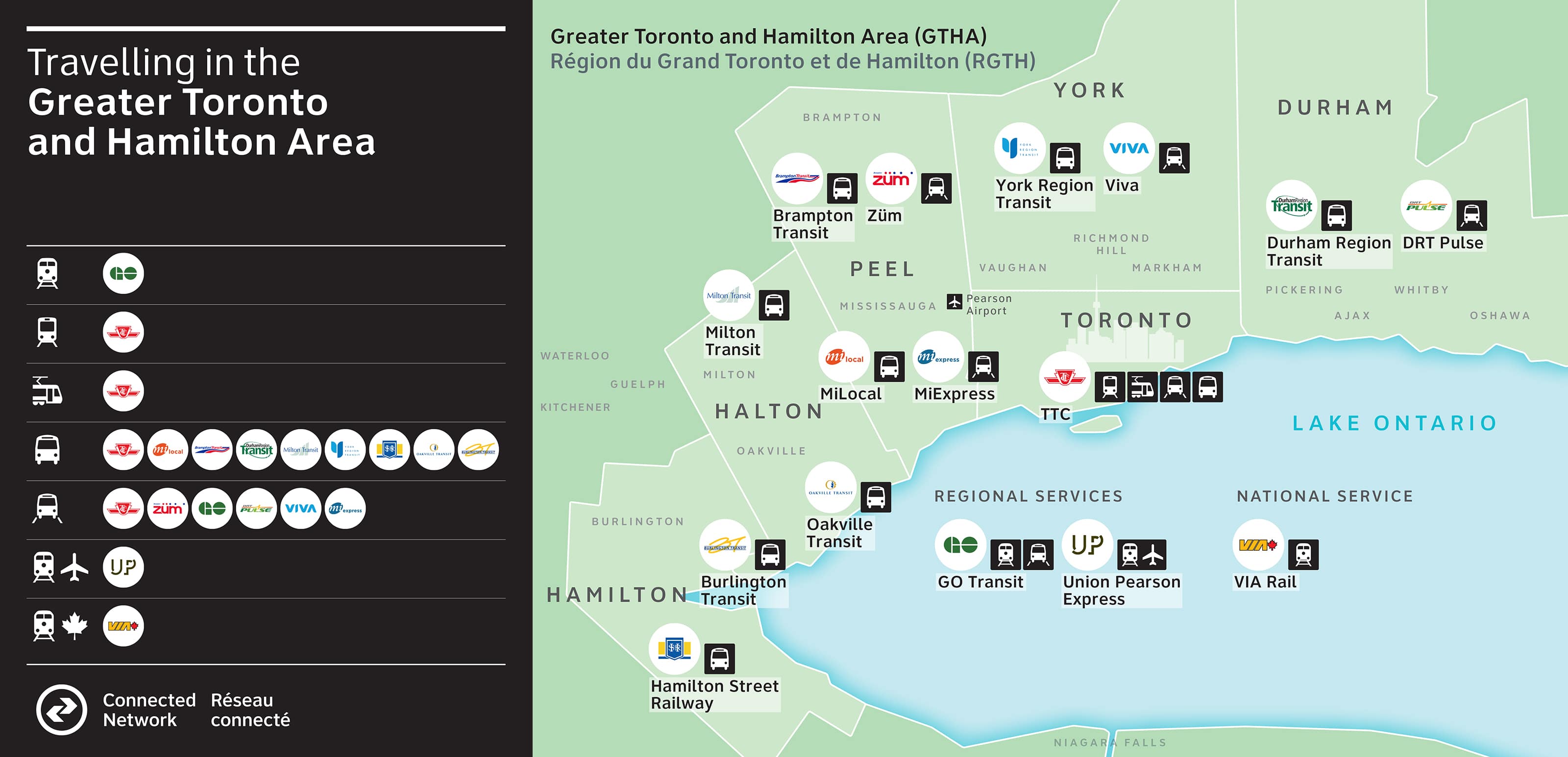
Eleven separate transit agencies and six modes of transport spanning across a vast region. Collectively they were operating without a coherent information strategy.


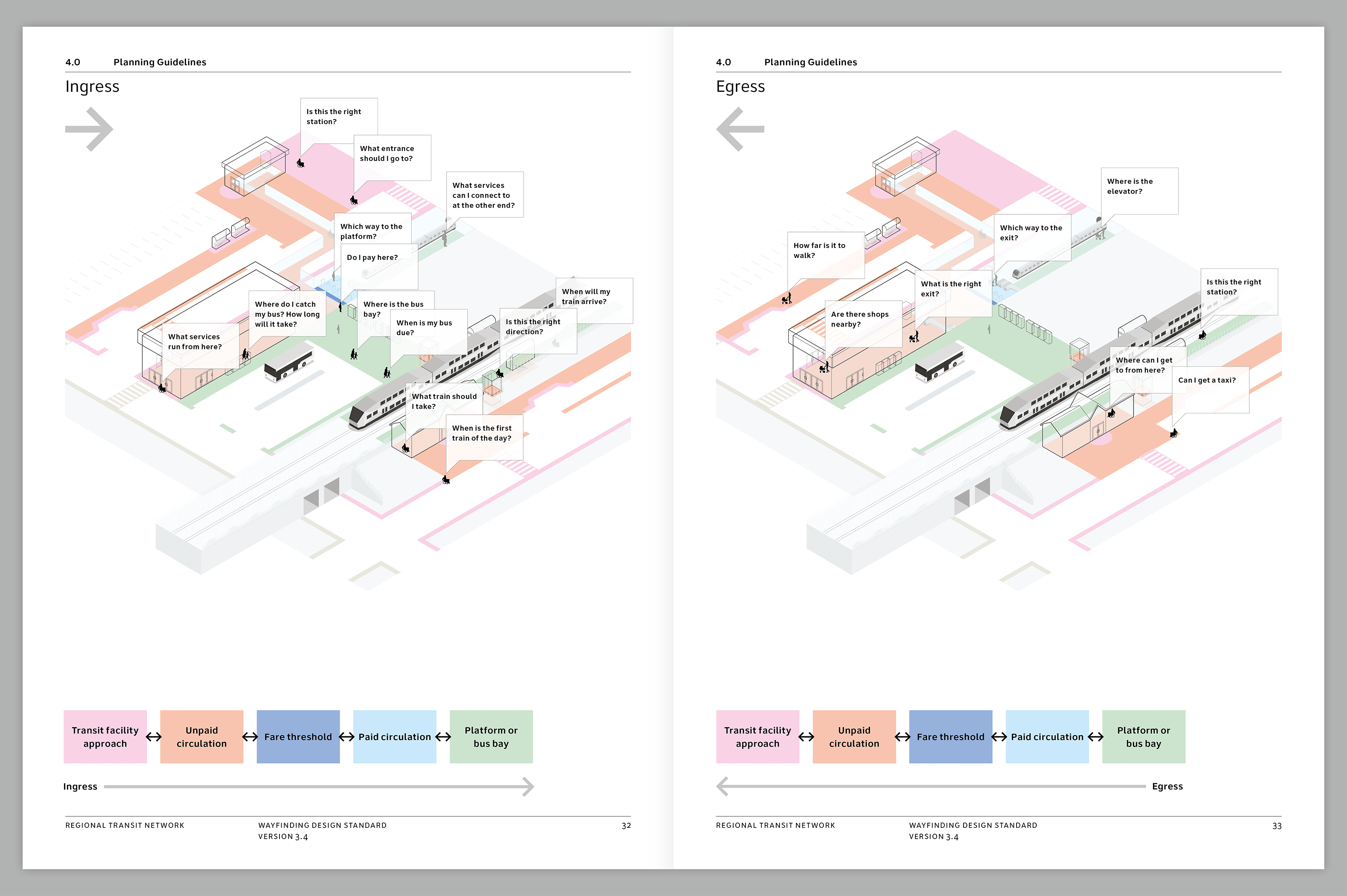
The research team went on every service to every corner of the network. The operating teams on the ground often have a good understanding of where the system is confusing and where there was a lack of information provision. There were many instances where different bus services operated from the same location, yet had the same bus number.

Harmonising the network required engagement and involvement of multiple stakeholders throughout the region. On a particularly contentious issue, co-design methods were used to enable different organisations to design the solution collaboratively.

The impact of better wayfinding and information provision has a significant ripple effect of benefits beyond just better information and design.

The use of a standardised symbol to represent transit across the region is designed to speak to the public. It can help make transit use easier to recognise and engage with. Early explorations of a network identifier helped regional stakeholders understand its possible form and meaning.
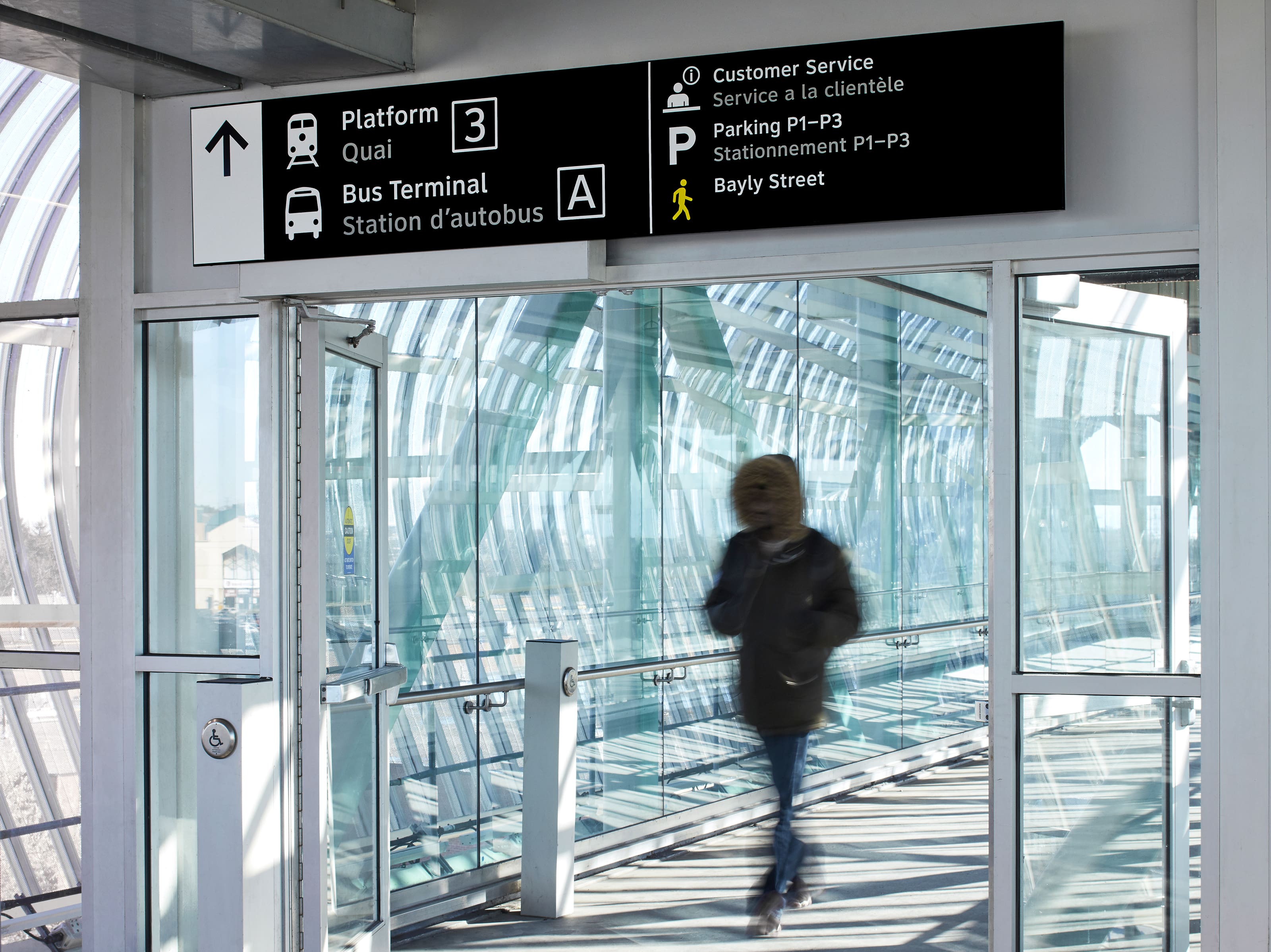

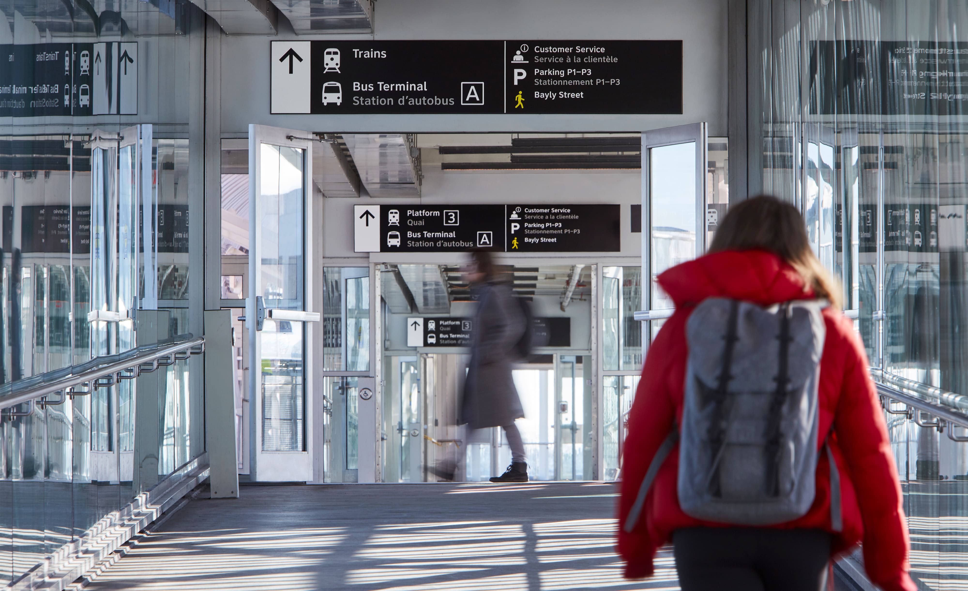
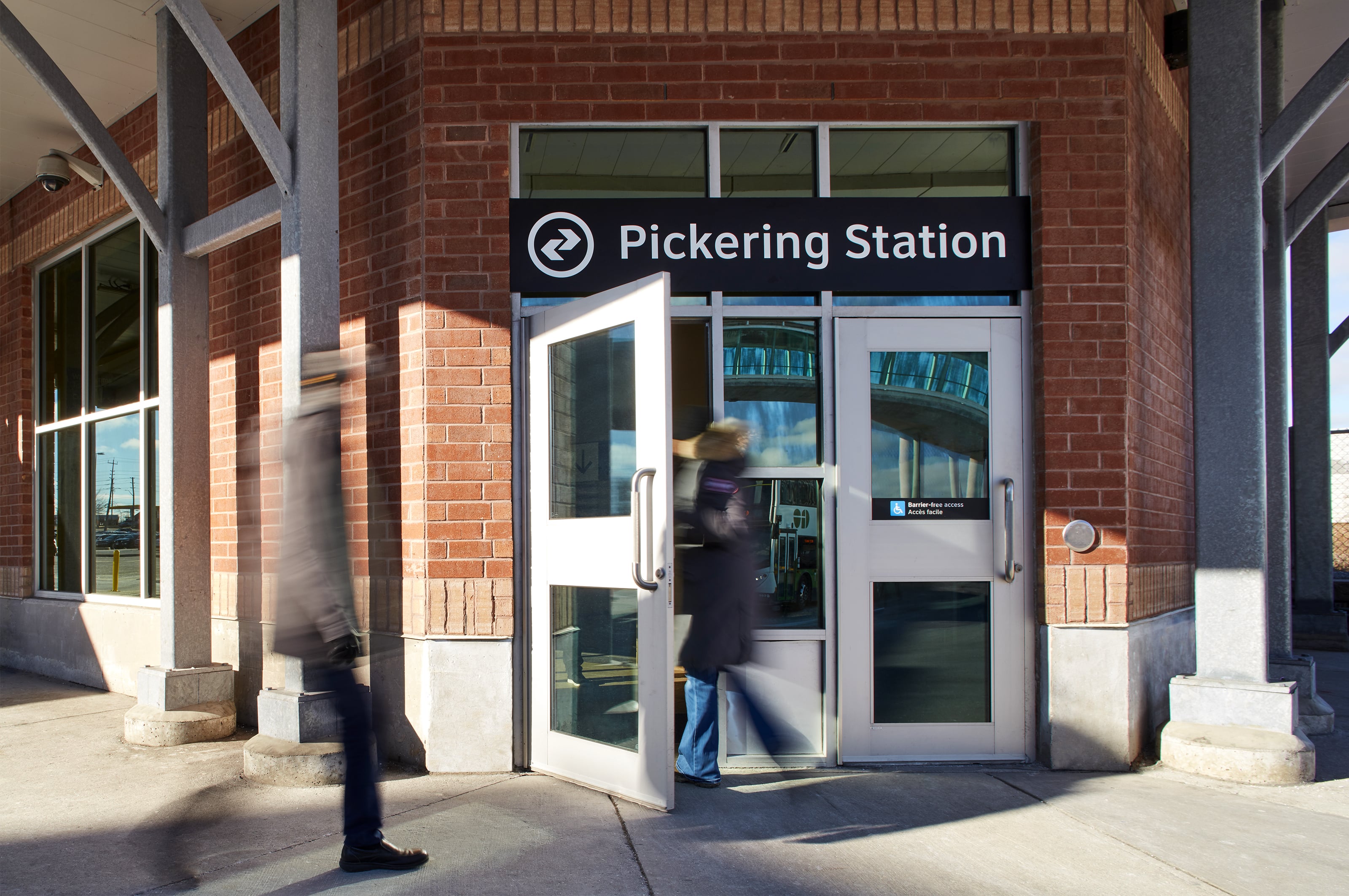
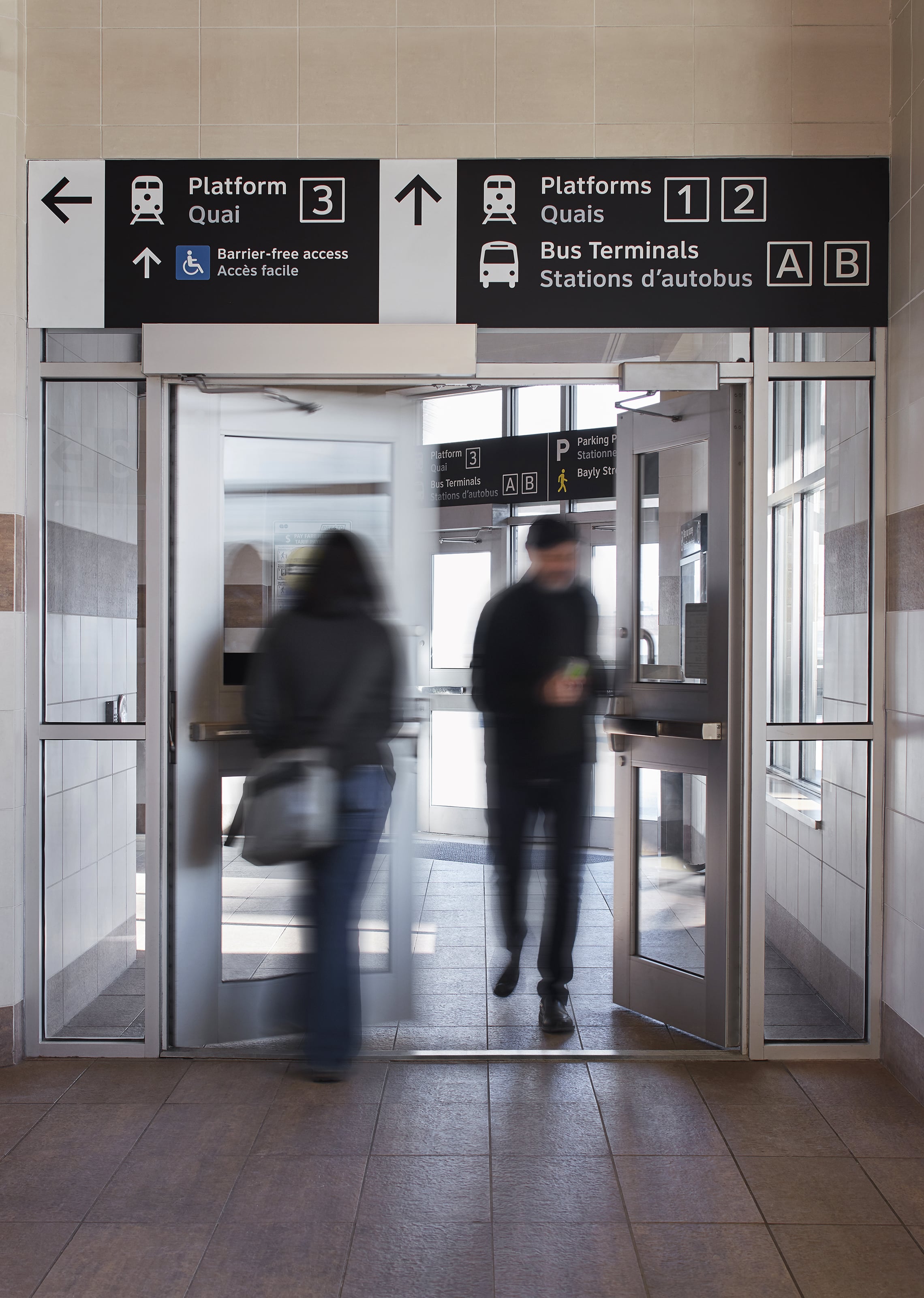
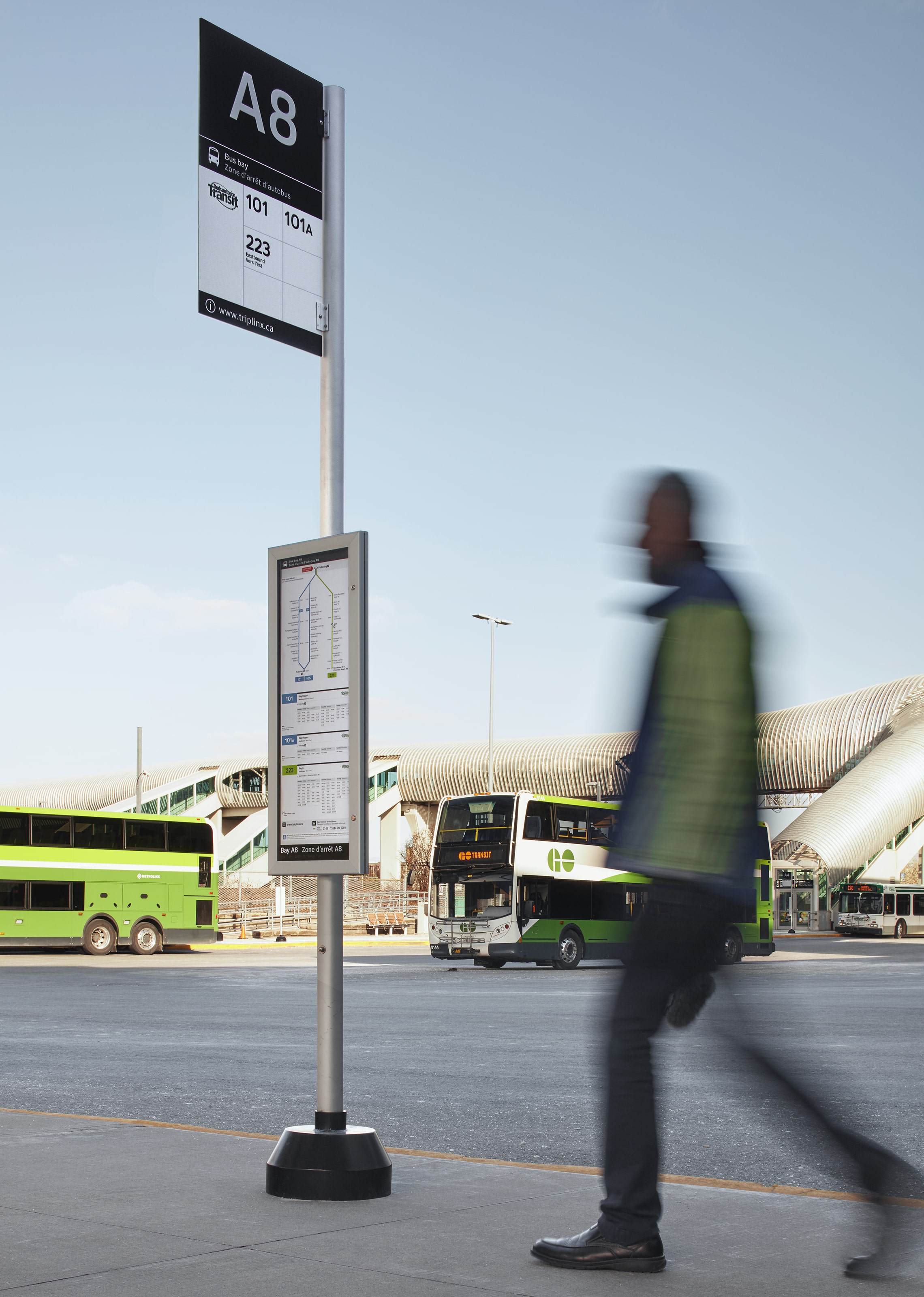
Prototype products were installed in key strategic stations in the region, solving local problems while refining the standards. This creates a system that can adapt to a multitude of different environments and situations – where it needs to perform.
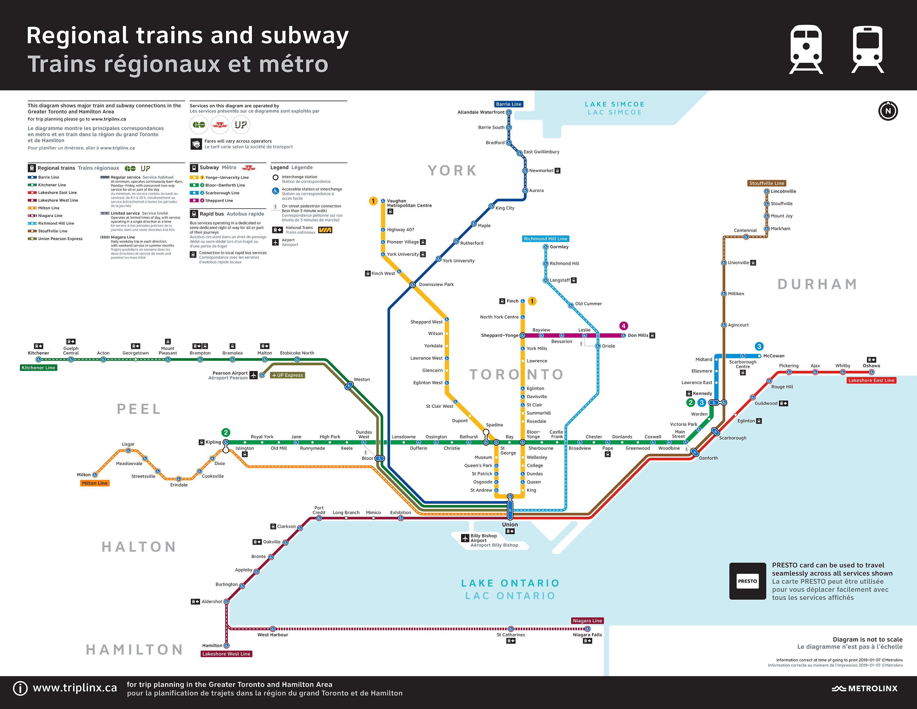
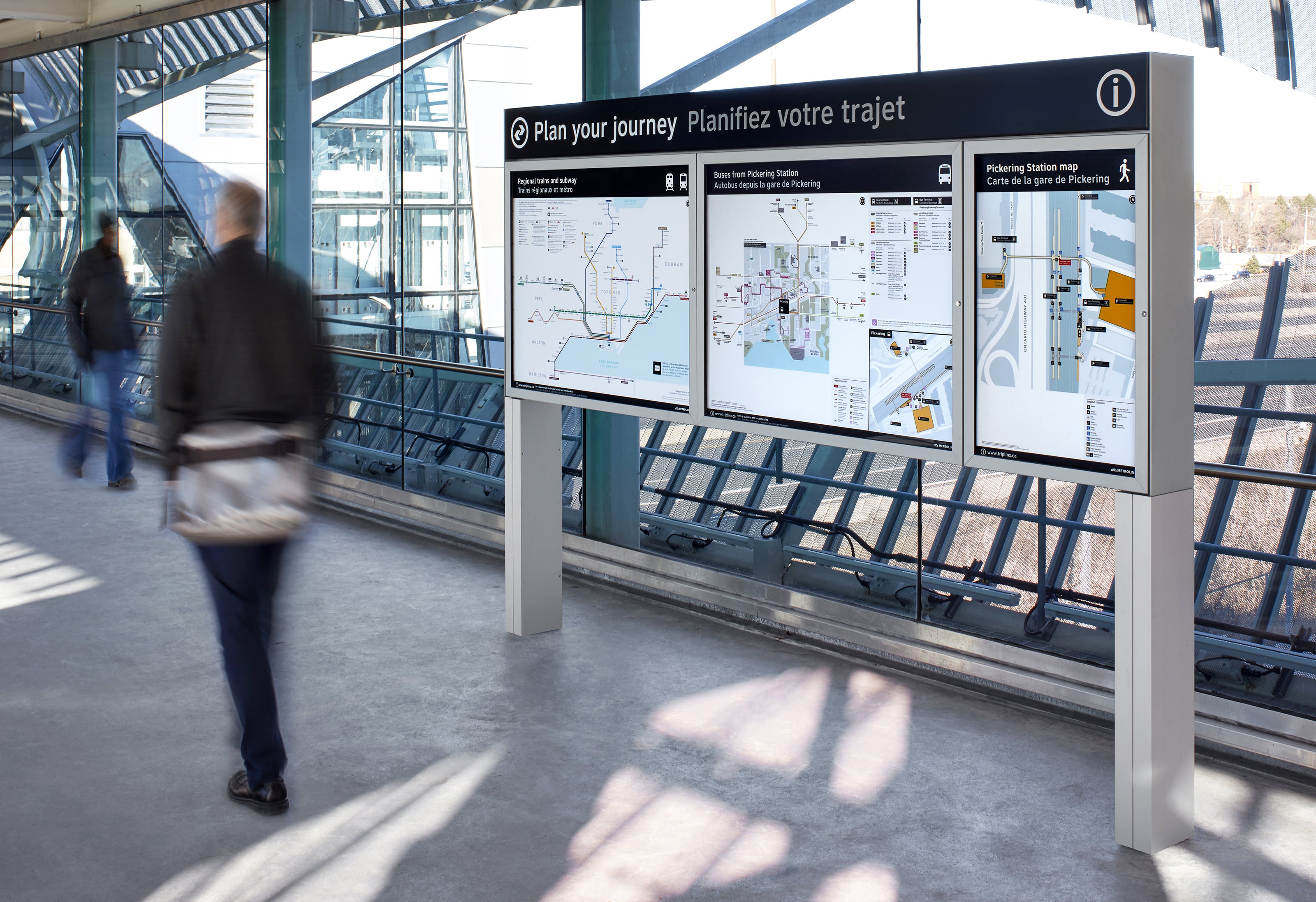
Explaining the complex Greater Toronto transport network is best achieved in a set of progressively scaled diagrams. These are placed in planned locations along journeys.
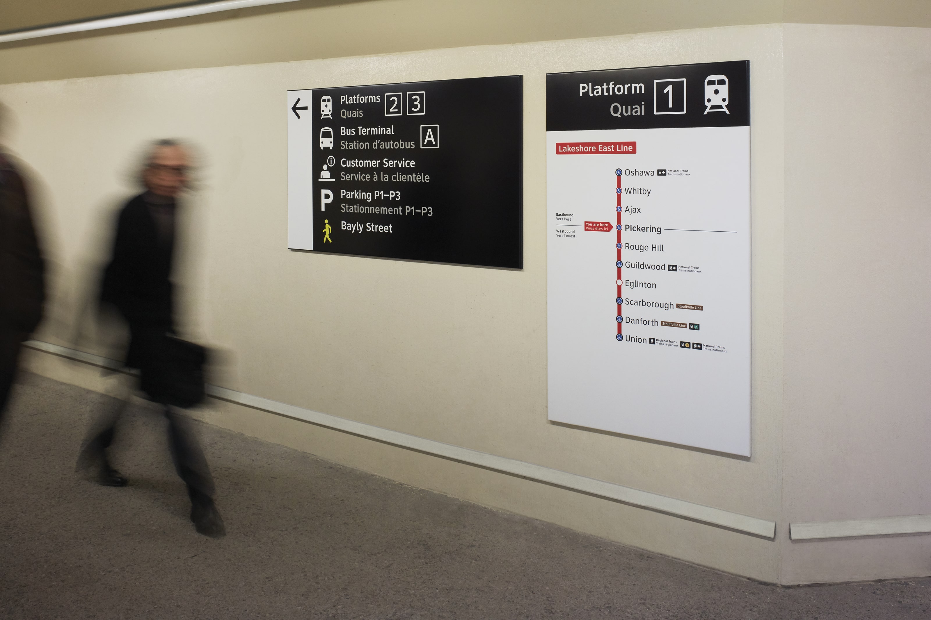
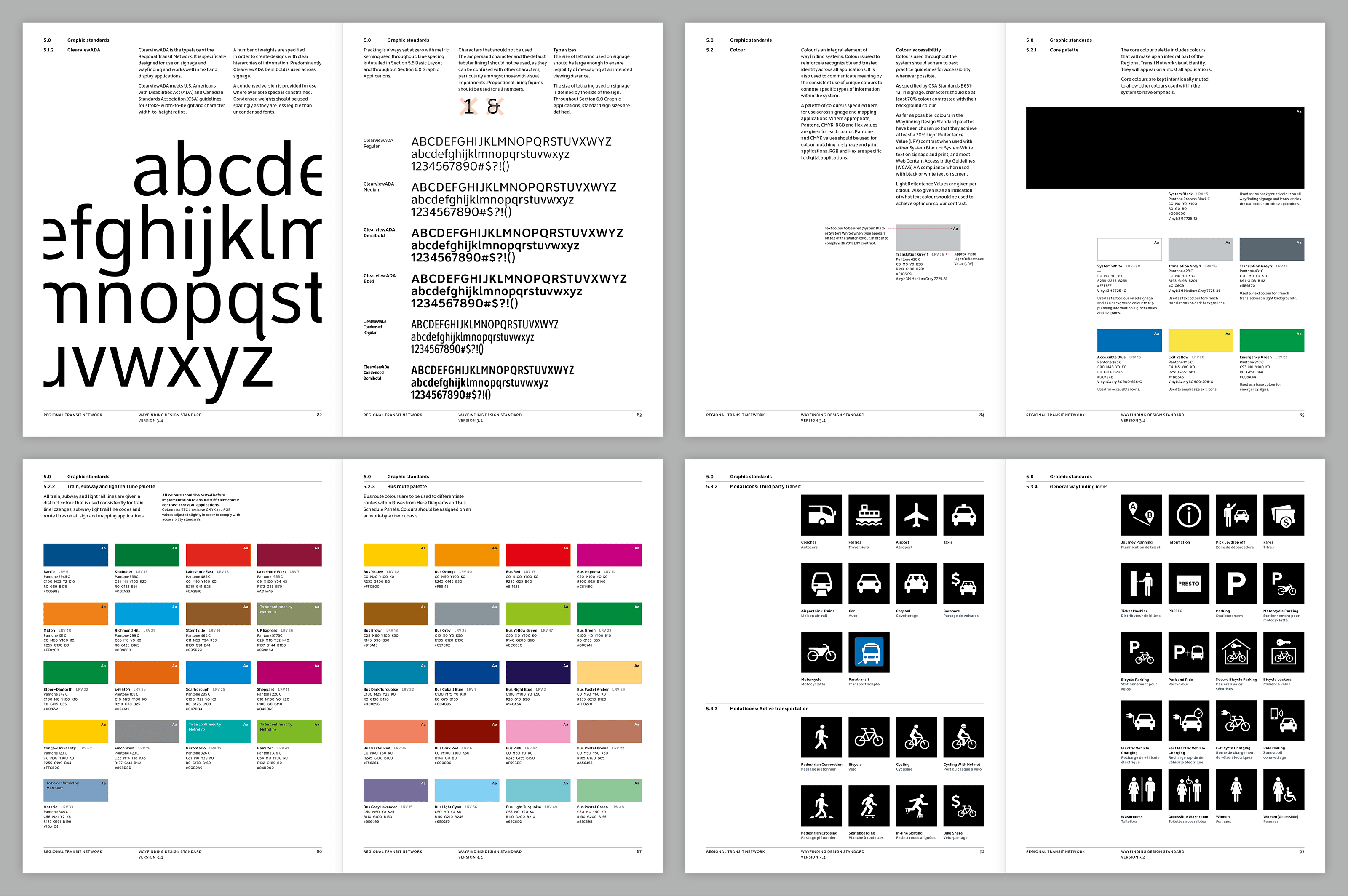
The system is designed to work across all the main transport modes in the region, harmonising route codes, station names and how information is represented. The aim is one system that is frighteningly easy to use.


The Toolkit informs the users of how their environment could bear the risks of clusters of transmission, and suggests the best possible layout of information in multiple types of places.
Seamless integration of public transit
Operating in the most populous metropolitan area in Canada, Metrolinx’s goal was to achieve seamless integration of public transit.
Many providers, one public
Eleven separate transit agencies and six modes of transport spanning across a vast region. Collectively they were operating without a coherent information strategy.
Travelling the region
The research team went on every service to every corner of the network. The operating teams on the ground often have a good understanding of where the system is confusing and where there was a lack of information provision. There were many instances where different bus services operated from the same location, yet had the same bus number.
Consensus building
Harmonising the network required engagement and involvement of multiple stakeholders throughout the region. On a particularly contentious issue, co-design methods were used to enable different organisations to design the solution collaboratively.
Many levels of benefits
The impact of better wayfinding and information provision has a significant ripple effect of benefits beyond just better information and design.
The idea of a network identifier
The use of a standardised symbol to represent transit across the region is designed to speak to the public. It can help make transit use easier to recognise and engage with. Early explorations of a network identifier helped regional stakeholders understand its possible form and meaning.
Prototyping with the public
Prototype products were installed in key strategic stations in the region, solving local problems while refining the standards. This creates a system that can adapt to a multitude of different environments and situations – where it needs to perform.
Regional network diagram
Explaining the complex Greater Toronto transport network is best achieved in a set of progressively scaled diagrams. These are placed in planned locations along journeys.
Multiple modes, one system
The system is designed to work across all the main transport modes in the region, harmonising route codes, station names and how information is represented. The aim is one system that is frighteningly easy to use.