
Rio de Janeiro has become a prominent host on the World stage: in recent years it has welcomed the 2014 World Cup, the Confederation Cup, the Pope, and the 2016 Summer Olympics; the Games’ first South American host.
Ahead of the Olympics, Rio’s desire was to improve and diversify the visitors’ and locals’ experiences of the city and better connect its attractions.
Applied devised and implemented a pedestrian wayfinding system of 500 units. This was installed across 75km² of the central areas of the city, encouraging exploration and walkability of the city in time for the Olympics and beyond..
tourists during the Rio 2016 Summer Olympics
of those tourists from outside Brazil

The pedestrian wayfinding system developed for the 2016 Olympics continues to help locals and visitors alike to navigate this complex, multi-layered, tropical, waterside city.

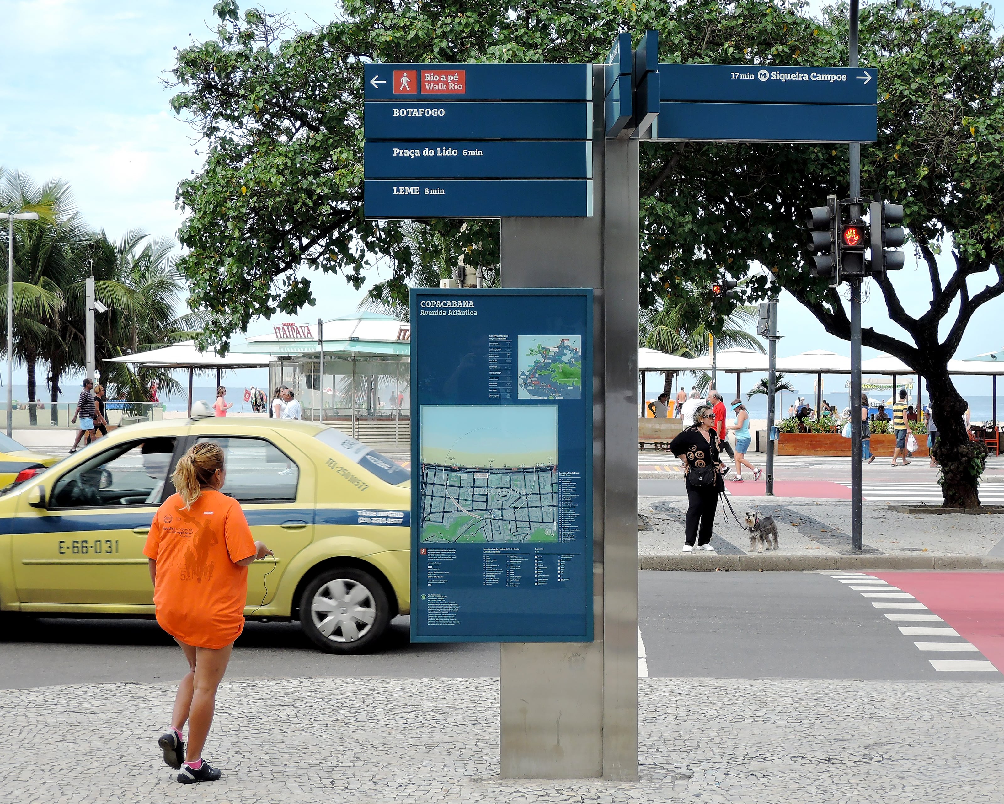
An information family including both map-based and directional information components help connect the City’s neighbourhoods sitting between the mountains and the sea.

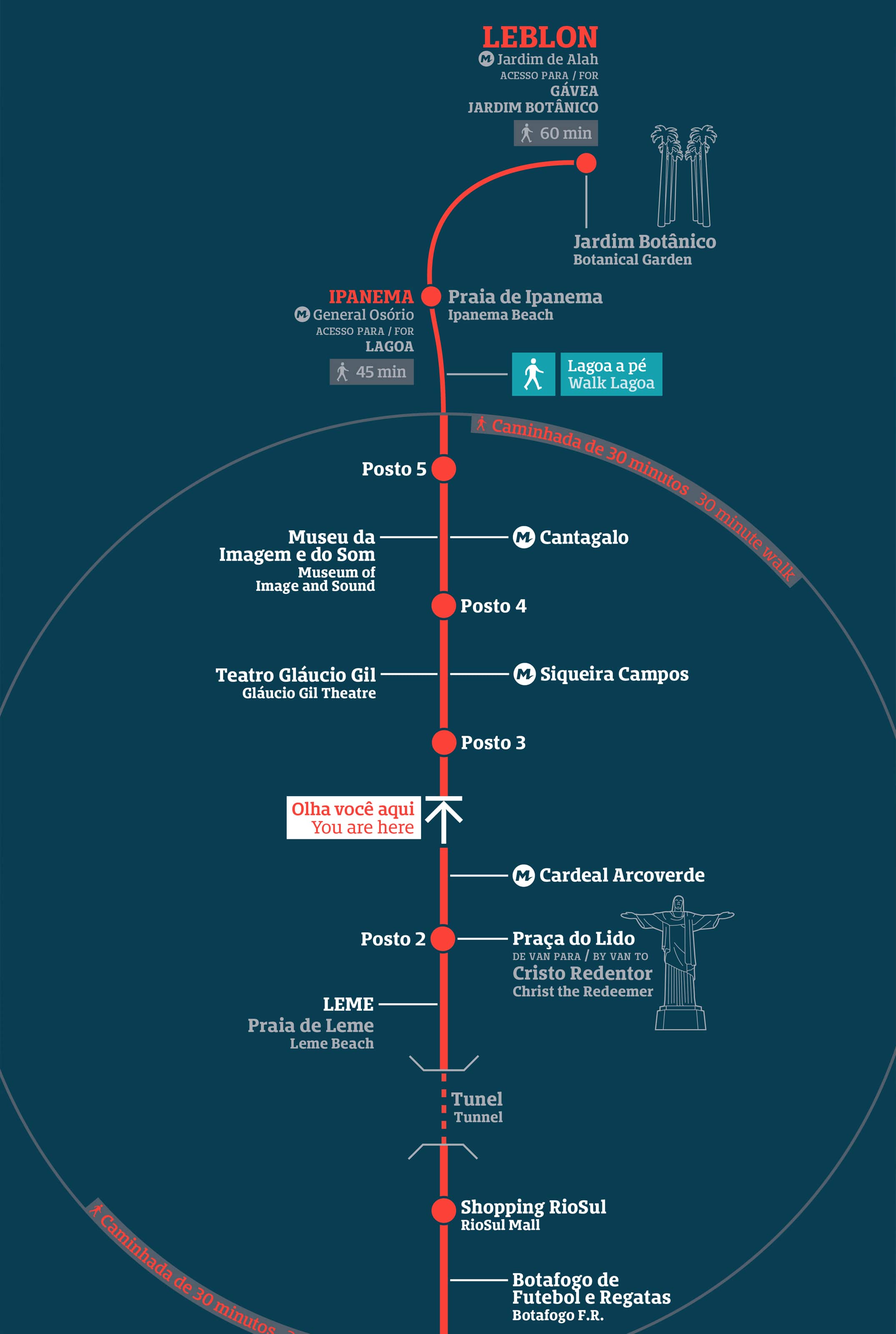
Walking routes connect the various City attractions. These routes were ambiguous and difficult to explore prior to the development and implementation of the system.

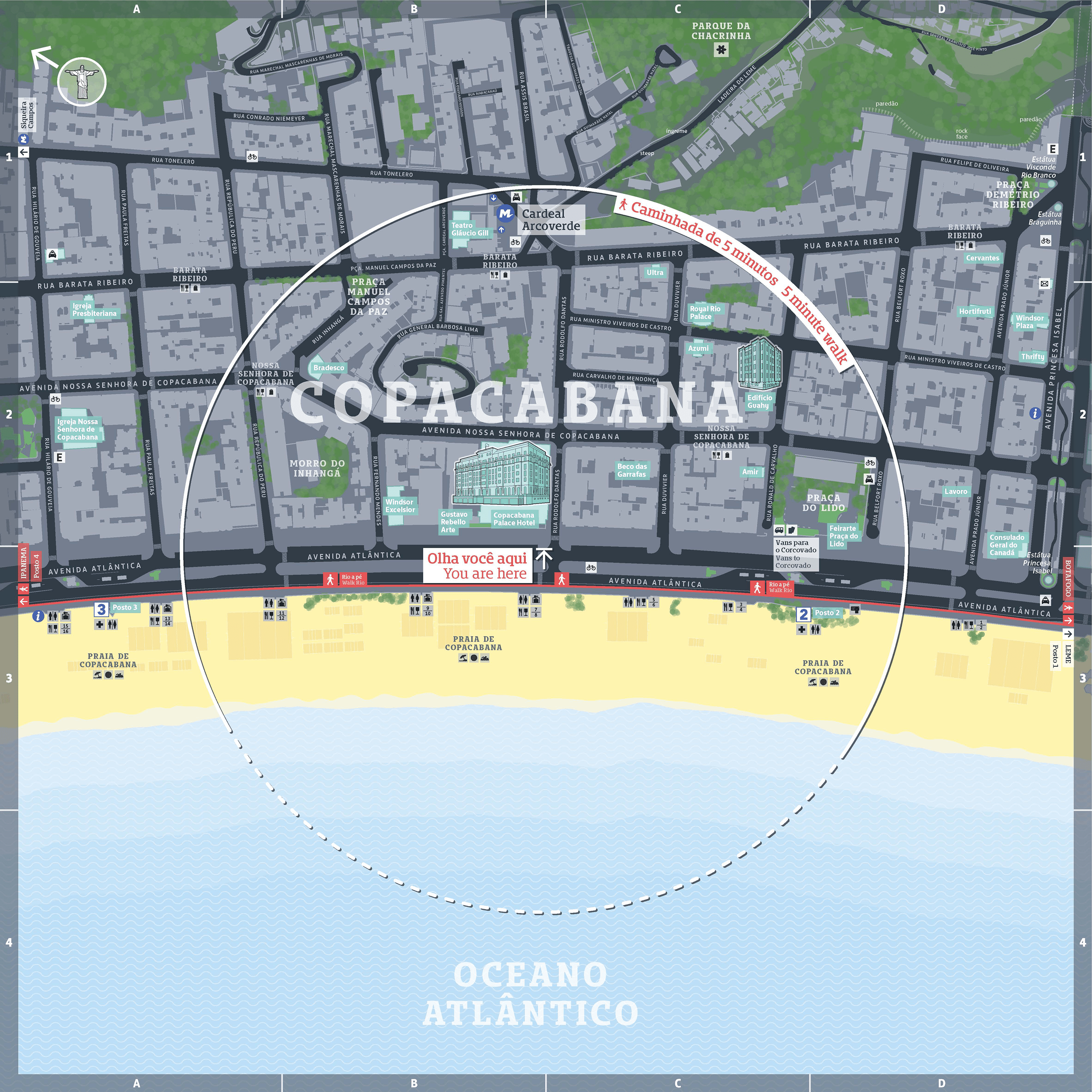
Map design captures the incredible landscape of Rio. The mountains and the sea feature on all maps to help users locate themselves in relation to these natural landmarks.

Illustrations of prominent architectural landmarks support natural landmarks on mapping to help users locate themselves at a hyper-local level of detail.


The Rio Olympics ended in 2016 but the system lives on. When in Rio, it is more common to orient oneself by referencing the statue of ‘Christ the Redeemer’ as opposed to True North.
Leaving an Olympic legacy
The pedestrian wayfinding system developed for the 2016 Olympics continues to help locals and visitors alike to navigate this complex, multi-layered, tropical, waterside city.
Information
An information family including both map-based and directional information components help connect the City’s neighbourhoods sitting between the mountains and the sea.
Walking routes
Walking routes connect the various City attractions. These routes were ambiguous and difficult to explore prior to the development and implementation of the system.
Landscape representation
Map design captures the incredible landscape of Rio. The mountains and the sea feature on all maps to help users locate themselves in relation to these natural landmarks.
Landmarks
Illustrations of prominent architectural landmarks support natural landmarks on mapping to help users locate themselves at a hyper-local level of detail.
System longevity
The Rio Olympics ended in 2016 but the system lives on. When in Rio, it is more common to orient oneself by referencing the statue of ‘Christ the Redeemer’ as opposed to True North.